ENVIRONMENTAL PROJECTS. PRECISION AGRICULTURE. DRONE & SPATIAL SOLUTIONS.
TALONYX provides specialist drone services, GIS, remote sensing and spatial analysis for environmental projects, natural resource management and precision agriculture throughout Southern Queensland and Northern New South Wales.For some clients, that means aerial surveying, GIS analysis and environmental intelligence. For others, it means precision spraying, granular spreading, weed mapping or crop and pasture monitoring. Every project starts with understanding the challenge and applying the right approach to achieve the best outcome.We partner with environmental teams, government, landholders and primary industries to collect better data, solve practical land management challenges and deliver better outcomes.
SPECIALIST SUPPORT FOR ENVIRONMENTAL PROJECTS
We work with:Environmental consultants
Government agencies and councils
Infrastructure owners
Conservation organisations
Landcare groups
Private landholdersWe provide specialist services that complement existing environmental teams — from aerial data collection and habitat monitoring to spatial analysis and practical field support. The result is better information, more efficient project delivery and stronger environmental outcomes.
PARTNERING FOR BETTER OUTCOMES
TALONYX partners with environmental consultants, government agencies, conservation organisations and land managers, providing specialist drone services, GIS, remote sensing and environmental intelligence to support every stage of environmental project delivery.Our services include:Ecological survey support
Habitat assessment and monitoring
Native vegetation and rehabilitation monitoring
Wetland, waterway and riparian monitoring
Weed mapping and invasive species management
Revegetation planning
Rehabilitation monitoring
Thermal fauna surveys
High-resolution mapping and spatial analysis
Development assessments and ecological constraints support
Aerial spraying and spreading
PRACTICAL SOLUTIONS FOR COMPLEX PROPERTIES
We work with:Orchard operators
Vineyard managers
Broadacre and grazing producers
Small acreage landholdersWhether you need better crop performance, faster weed control or smarter land management, TALONYX provides practical, efficient solutions tailored to your property.
MULTISPECTRAL & LAND SURVEYS
See what’s happening before problems become expensive.We provide advanced aerial surveys to identify:Crop stress
Irrigation issues
Nutrient deficiencies
Weed pressure
Plant health variability
Pasture performance
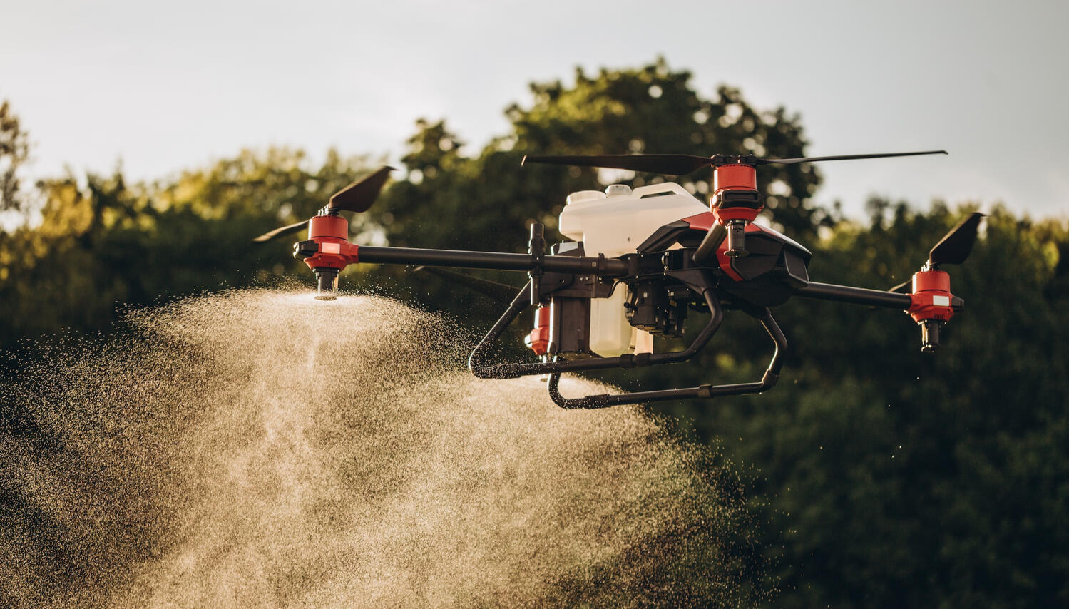
PRECISION SPRAYING
Fast, targeted application where conventional equipment struggles.Ideal for:Orchards
Vineyards
Steep terrain
Wet ground
Difficult access areas
Spot spraying and precision treatment
PRECISION SPREADING
Accurate aerial spreading for difficult terrain and large areas.Suitable for:Fertilisers
Granular herbicides
Seed
Soil amendments
Pasture improvement products
LET'S EXPLORE WHAT'S POSSIBLE
Every property and project is different. We'll take the time to understand your objectives, answer your questions and recommend the most effective solution to achieve the best outcome.Use the form below to request your free property or project assessment or call us on 0448 938 068.
WHY ENVIRONMENTAL PROFESSIONALS CHOOSE TALONYX
Built by environmental scientists: TALONYX is led by experienced environmental professionals who understand the challenges of ecological surveys, monitoring, compliance and project delivery - not just drone operations.
A specialist extension of your team: We combine environmental expertise with advanced drone, GIS and remote sensing capability to help deliver better data, meaningful intelligence and stronger environmental outcomes.
WHY FARMERS & LANDHOLDERS CHOOSE TALONYX
Practical solutions for real property challenges: From precision spraying and granular spreading to weed mapping and crop monitoring, we help improve productivity while reducing time, labour and input costs.
Technology that works for your land: We apply the right drone, mapping and spatial technologies to help you manage difficult terrain, monitor change and make more informed decisions.
TALONYX CAPABILITIES
Licences:
CASA RPA Operator's Certificate (ReOC) ARN 1135558
Aerial Distribution Contractor Licence ADC245923
Equipment includes:
DJI Agras T100 Spray & Spread
DJI Mavic 3M (multispectral imagery)
DJI Matrice 4TD (thermal imagery)
DJI M350 RTK
Ground Rig
About TALONYX
© 2025 Leighton Davis Pty Ltd t/a TALONYXLocations
We support projects throughout Southern Queensland and Northern New South Wales from operating bases in both the Sunshine Coast and New England Tablelands.Privacy
We collect the information you submit through our forms to respond to enquiries, provide quotes, and deliver services. Your information is kept secure and is never sold or shared with third parties except where required to provide our services or by law.Terms
All information on this website is general in nature and subject to change without notice. Quotes, services and availability are provided subject to site assessment, operational requirements and applicable regulations.
SPECIALIST AERIAL SUPPORT FOR ENVIRONMENTAL CONSULTANCIES
Environmental consultants do not need another drone company. They need a field partner who understands environmental consulting, project delivery, site constraints, deadlines, reporting requirements and client expectations.TALONYX provides project-by-project aerial capability for consultancies across Queensland and Northern NSW. We support your team where drone technology genuinely adds value and stay out of the way where it does not.TALONYX helps environmental consultants, ecologists and project teams collect reliable field data or apply prescription aerial treatments when drone capability can improve safety, access, monitoring or reporting.We are comfortable working as a discreet subcontractor under your brand where required. Our role is to capture reliable aerial data, provide clean outputs, and support your project team with smart aerial solutions without complicating client relationships. We can assist at proposal stage, during field delivery or as overflow support when internal UAV capability is unavailable.TALONYX is built around environmental project outcomes, not generic drone imagery. Our focus is on practical data capture, field efficiency, precise and repeatable methods, and outputs that help consultants interpret, report, advise and improve.Need specialist aerial support for an environmental project? Use the form below to send us a short project brief or call us on 0448 938 068 to discuss site location, timing, deliverables and constraints. Or keep reading to see the services we offer and download our Capability Statement.
PROBLEMS WE HELP SOLVE
Lack of capability internally (CASA compliance)
Difficult terrain or unsafe access
Large sites that are slow to inspect on foot
Repeat monitoring requirements
Vegetation and rehabilitation evidence
Fauna and habitat survey support
GIS-ready spatial outputs for reporting
Prescription aerial applications of liquid and gradular treatments
Busy project periods where internal teams need extra capacity
SERVICES
Thermal fauna and wildlife survey support
Multispectral vegetation assessment
Rehabilitation and restoration monitoring
Weed mapping and environmental management support
Wetland, riparian and waterway monitoring
High-resolution orthomosaics and site evidence
Difficult-access inspections
GIS-ready deliverables for consultant workflows
Precision aerial application of liquid and gradular treatments
FAQs
| Question | Answer |
|---|---|
| Do you replace our environmental consultants? | No. TALONYX supports your project team with aerial data capture, treatment and related analysis / outputs as required. Your consultants retain responsibility for interpretation, reporting and client engagement / advice. |
| Can you work as a subcontractor? | Yes. TALONYX can work directly with your team or discreetly as a subcontractor where that better suits the client relationship. |
| What information do you need for a quote? | A site location or boundary, project objective, timing, required outputs, access constraints and any relevant operational or reporting requirements. |
| Do you provide GIS-ready deliverables? | Yes. Where required, outputs can be prepared for integration with consultant GIS and reporting workflows. |
| Do you operate nationally? | We primarily service Southern Queensland and Northern New South Wales, with other regions considered depending on project requirements and timing. |
| Do you hold all necessary licenses and permits to conduct work? | TALONYX holds a Remotely Piloted Aircraft Operator's Certificate (ReOC) issued by CASA, and all of our pilots hold Remote Pilot Licenses (RePL). We are also licensed to conduct aerial spraying and spreading in both Queensland and New South Wales. We hold comprehensive public liability and professional insurances. |
THERMAL FAUNA SURVEY SUPPORT FOR ECOLOGY PROJECTS
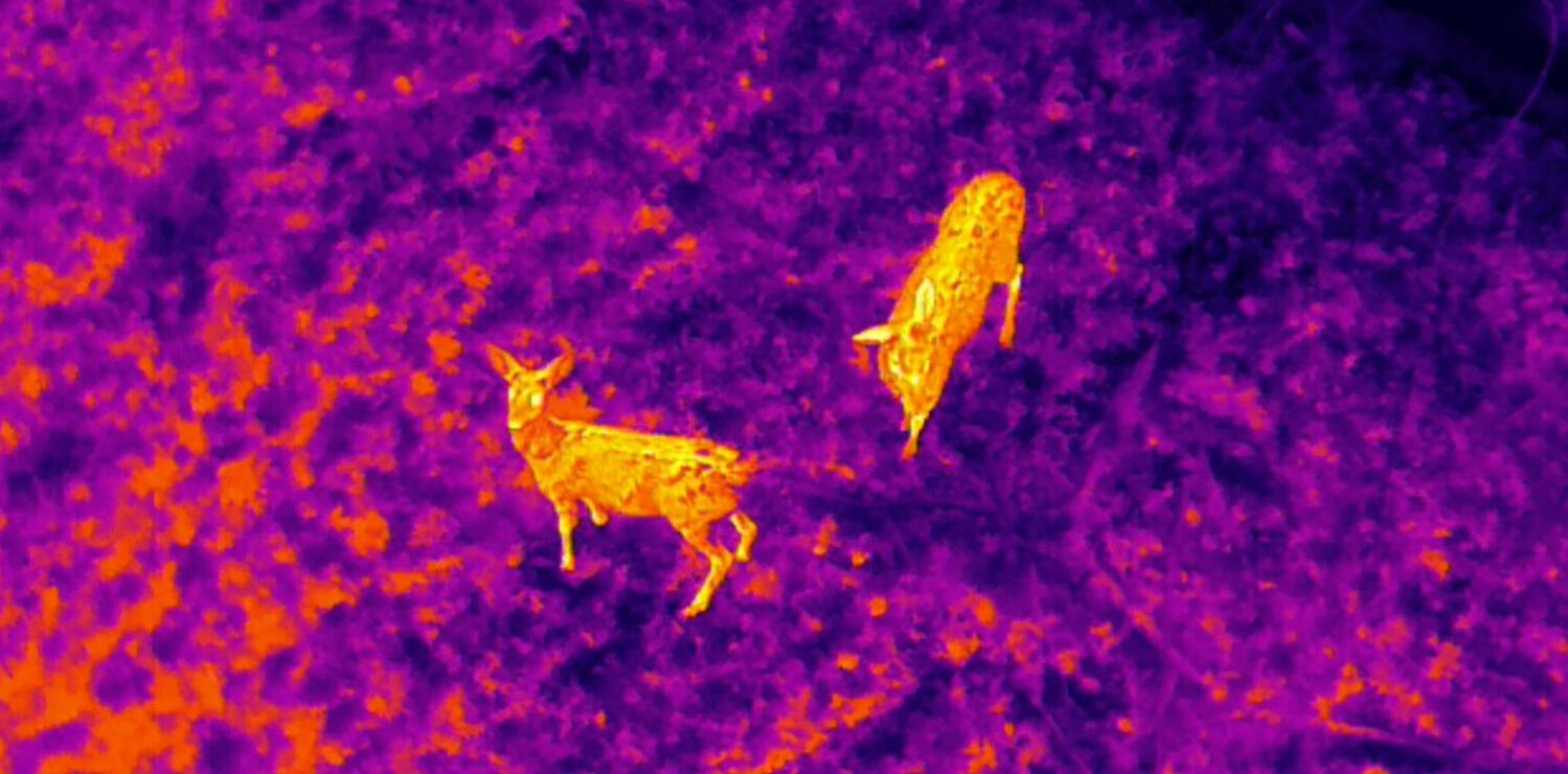
Thermal drones are not a replacement for ecological expertise. Used appropriately, they are a field-support tool that can help ecologists identify areas of interest, cover difficult terrain more efficiently and collect additional evidence for project decision-making.TALONYX provides specialist thermal drone capability for environmental consultants needing additional field data for fauna, habitat and difficult-access survey work.Your ecologists remain responsible for survey design, interpretation and reporting. TALONYX supports the field component by planning safe drone operations, capturing thermal and visual data, and providing quality outputs that can be reviewed by your technical team and incorporated into client deliverables. We can work as a subcontractor and align with your survey protocols.Thermal data is influenced by vegetation density, weather, time of day, animal behaviour and site conditions. TALONYX does not oversell drone detection. We help your ecology team determine whether thermal aerial survey is suitable and design the flight approach accordingly.TALONYX is built around environmental project outcomes, not generic drone imagery. Our focus is on practical data capture, field efficiency, precise and repeatable methods, and outputs that help consultants interpret, report, advise and improve.Planning a fauna survey where thermal drone support may improve coverage, access or evidence? Use the form below to send us a short project brief or call us on 0448 938 068 to discuss site location, timing, deliverables and constraints. Or keep reading to see the services we offer and download our Capability Statement.
WHERE THERMAL DRONE SURVEYS CAN ASSIST
Koala and arboreal fauna search support
Macropod and larger fauna detection
Nocturnal or dawn survey support
Riparian, wetland and waterway fauna surveys
Coastal and marine ecological survey support
Difficult-access vegetation and habitat areas
Development assessment and ecological constraints work
Rehabilitation and offset monitoring
Pre-clearance and targeted field investigation support
DELIVERABLES
Thermal imagery and video
High-resolution visual context imagery
Location-tagged observations where appropriate
Orthomosaic or site overview products
GIS-ready spatial layers where required
Field notes and operational metadata
FAQs
| Question | Answer |
|---|---|
| Do you replace our environmental consultants? | No. TALONYX supports your project team with aerial data capture, treatment and related analysis / outputs as required. Your consultants retain responsibility for interpretation, reporting and client engagement / advice. |
| Can you work as a subcontractor? | Yes. TALONYX can work directly with your team or discreetly as a subcontractor where that better suits the client relationship. |
| What information do you need for a quote? | A site location or boundary, project objective, timing, required outputs, access constraints and any relevant operational or reporting requirements. |
| Do you provide GIS-ready deliverables? | Yes. Where required, outputs can be prepared for integration with consultant GIS and reporting workflows. |
| Do you operate nationally? | We primarily service Southern Queensland and Northern New South Wales, with other regions considered depending on project requirements and timing. |
| Do you hold all necessary licenses and permits to conduct work? | TALONYX holds a Remotely Piloted Aircraft Operator's Certificate (ReOC) issued by CASA, and all of our pilots hold Remote Pilot Licenses (RePL). We are also licensed to conduct aerial spraying and spreading in both Queensland and New South Wales. We hold comprehensive public liability and professional insurances. |
REPEATABLE DRONE MONITORING FOR REHABILITATION & RESTORATION PROJECTS
Rehabilitation monitoring is often constrained by time, access and the need for consistent evidence across multiple reporting periods. Drone-based monitoring can provide repeatable visual and multispectral datasets that help consultants, site managers and agencies track change over time.TALONYX helps environmental teams monitor site recovery, vegetation condition and compliance evidence with repeatable aerial data across Queensland and Northern NSW.The value is not just one flight. It is the ability to return to the same site, capture comparable datasets and build a defensible visual record of change. This can assist with client reporting, regulator conversations, internal planning and adaptive management.TALONYX is built around environmental project outcomes, not generic drone imagery. Our focus is on practical data capture, field efficiency, precise and repeatable methods, and outputs that help consultants interpret, report, advise and improve.Need a repeatable monitoring method for rehabilitation, offset or restoration reporting? Use the form below to send us a short project brief or call us on 0448 938 068 to discuss site location, timing, deliverables and constraints. Or keep reading to see the services we offer and download our Capability Statement.
PROJECTS WE SUPPORT
Mine and quarry rehabilitation
Renewable energy and infrastructure restoration
Biodiversity offsets
Construction rehabilitation areas
Riparian and wetland restoration
Weed treatment follow-up
Erosion and access track monitoring
Government restoration programs
WHAT WE CAN CAPTURE
High-resolution site imagery
Orthomosaics for change detection
Multispectral vegetation indices
Bare ground and vegetation cover trends
Weed extent and priority zones
Erosion or drainage features
Progress evidence for reporting
FAQs
| Question | Answer |
|---|---|
| Do you replace our environmental consultants? | No. TALONYX supports your project team with aerial data capture, treatment and related analysis / outputs as required. Your consultants retain responsibility for interpretation, reporting and client engagement / advice. |
| Can you work as a subcontractor? | Yes. TALONYX can work directly with your team or discreetly as a subcontractor where that better suits the client relationship. |
| What information do you need for a quote? | A site location or boundary, project objective, timing, required outputs, access constraints and any relevant operational or reporting requirements. |
| Do you provide GIS-ready deliverables? | Yes. Where required, outputs can be prepared for integration with consultant GIS and reporting workflows. |
| Do you operate nationally? | We primarily service Southern Queensland and Northern New South Wales, with other regions considered depending on project requirements and timing. |
| Do you hold all necessary licenses and permits to conduct work? | TALONYX holds a Remotely Piloted Aircraft Operator's Certificate (ReOC) issued by CASA, and all of our pilots hold Remote Pilot Licenses (RePL). We are also licensed to conduct aerial spraying and spreading in both Queensland and New South Wales. We hold comprehensive public liability and professional insurances. |
DRONE WEED MAPPING & TREATMENT FOR ENVIRONMENTAL MANAGEMENT PROJECTS
Effective weed management starts with knowing where the problem is, how large it is, how accessible it is and how it is changing over time. Drone mapping can provide a practical overview of weed extent and help teams plan targeted ground or aerial treatment.TALONYX helps consultants, land managers and agencies map weed extent, priority zones and access constraints before treatment or monitoring works begin.TALONYX can help identify weed extent and priority zones before significant money is spent on control. Where appropriate and compliant with label, site and regulatory requirements, we can also provide aerial application options for targeted weed management.Aerial weed mapping can reduce wasted effort, improve treatment planning, help justify budgets and provide a repeatable record of progress. For consultancies, it can strengthen environmental management plans and provide clearer evidence for clients.TALONYX is built around environmental project outcomes, not generic drone imagery. Our focus is on practical data capture, field efficiency, precise and repeatable methods, and outputs that help consultants interpret, report, advise and improve.Planning a weed management project or needing better site evidence? Use the form below to send us a short project brief or call us on 0448 938 068 to discuss site location, timing, deliverables and constraints. Or keep reading to see the services we offer and download our Capability Statement.
WHERE WEED MAPPING HELPS
Riparian and wetland weed infestations
Steep or difficult-access terrain
Rehabilitation and offset areas
Roadsides, easements and infrastructure corridors
Rural properties and environmental reserves
Pre-treatment planning
Post-treatment follow-up
Grant or compliance reporting
DELIVERABLES
High-resolution aerial site imagery
Orthomosaic map outputs
Marked priority zones
GIS-ready weed extent layers where feasible
Access constraint notes
Before-and-after monitoring evidence
Mission-ready aerial application plans and execution
FAQs
| Question | Answer |
|---|---|
| Do you replace our environmental consultants? | No. TALONYX supports your project team with aerial data capture, treatment and related analysis / outputs as required. Your consultants retain responsibility for interpretation, reporting and client engagement / advice. |
| Can you work as a subcontractor? | Yes. TALONYX can work directly with your team or discreetly as a subcontractor where that better suits the client relationship. |
| What information do you need for a quote? | A site location or boundary, project objective, timing, required outputs, access constraints and any relevant operational or reporting requirements. |
| Do you provide GIS-ready deliverables? | Yes. Where required, outputs can be prepared for integration with consultant GIS and reporting workflows. |
| Do you operate nationally? | We primarily service Southern Queensland and Northern New South Wales, with other regions considered depending on project requirements and timing. |
| Do you hold all necessary licenses and permits to conduct work? | TALONYX holds a Remotely Piloted Aircraft Operator's Certificate (ReOC) issued by CASA, and all of our pilots hold Remote Pilot Licenses (RePL). We are also licensed to conduct aerial spraying and spreading in both Queensland and New South Wales. We hold comprehensive public liability and professional insurances. |
DRONE MONITORING FOR WETLANDS, WATERWAYS & RIPARIAN MONITORING
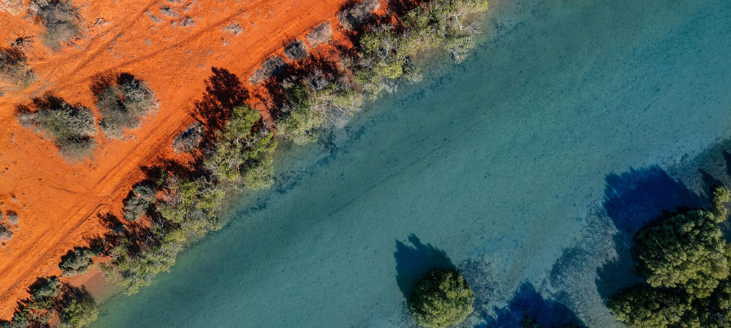
Wetlands and waterways are often difficult to access, slow to survey from the ground and sensitive to disturbance. Drone-based monitoring can help project teams understand site condition, vegetation extent, shoreline change and access constraints while supporting repeatable evidence over time.TALONYX supports aquatic and environmental project teams with aerial data for wetland, river, riparian and coastal monitoring across Queensland and Northern NSW.TALONYX does not replace aquatic ecology, hydrology or coastal engineering expertise. We provide aerial field data that helps technical specialists see the site, target fieldwork, monitor change and communicate findings to clients or stakeholders.Aerial data can be especially useful where ground access is limited, vegetation is dense, banks are unstable, or project teams need a visual record of change across a broad area. Repeat flights can also provide a consistent evidence base for management decisions.TALONYX is built around environmental project outcomes, not generic drone imagery. Our focus is on practical data capture, field efficiency, precise and repeatable methods, and outputs that help consultants interpret, report, advise and improve.Need aerial support for a wetland, riparian or waterway project? Use the form below to send us a short project brief or call us on 0448 938 068 to discuss site location, timing, deliverables and constraints. Or keep reading to see the services we offer and download our Capability Statement.
PROJECTS WE SUPPORT
Wetland condition monitoring
Riparian vegetation assessment
Riverbank and erosion monitoring
Mangrove, saltmarsh and coastal vegetation mapping
Restoration and rehabilitation monitoring
Waterway access and constraints mapping
Environmental approvals and compliance evidence
Council and government natural area programs
USEFUL OUTPUTS
High-resolution aerial imagery
Orthomosaics and site maps
Vegetation extent mapping
Shoreline and bank condition evidence
Multispectral vegetation assessment where suitable
GIS-ready layers for consultant workflows
Repeat monitoring datasets
FAQs
| Question | Answer |
|---|---|
| Do you replace our environmental consultants? | No. TALONYX supports your project team with aerial data capture, treatment and related analysis / outputs as required. Your consultants retain responsibility for interpretation, reporting and client engagement / advice. |
| Can you work as a subcontractor? | Yes. TALONYX can work directly with your team or discreetly as a subcontractor where that better suits the client relationship. |
| What information do you need for a quote? | A site location or boundary, project objective, timing, required outputs, access constraints and any relevant operational or reporting requirements. |
| Do you provide GIS-ready deliverables? | Yes. Where required, outputs can be prepared for integration with consultant GIS and reporting workflows. |
| Do you operate nationally? | We primarily service Southern Queensland and Northern New South Wales, with other regions considered depending on project requirements and timing. |
| Do you hold all necessary licenses and permits to conduct work? | TALONYX holds a Remotely Piloted Aircraft Operator's Certificate (ReOC) issued by CASA, and all of our pilots hold Remote Pilot Licenses (RePL). We are also licensed to conduct aerial spraying and spreading in both Queensland and New South Wales. We hold comprehensive public liability and professional insurances. |
DEVELOPMENT ASSESSMENT & ECOLOGICAL CONSTRAINTS SUPPORT
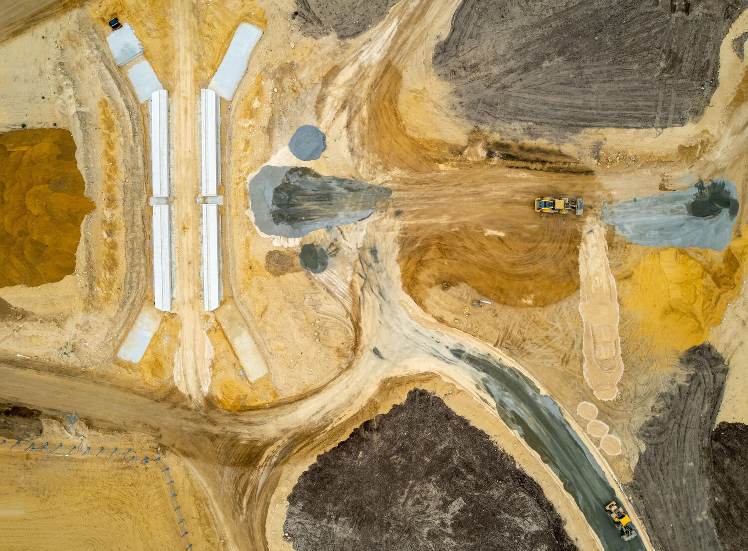
Development approvals rely on accurate environmental information.TALONYX provides specialist aerial mapping and survey support that helps environmental consultants collect consistent, repeatable and GIS-ready datasets across projects ranging from small developments to major infrastructure.Rather than replacing field ecologists, we help them work more efficiently by supplying high-quality aerial information before, during and after site investigations.Rapid aerial field support for environmental consultancies, planners and government agencies delivering development approvals, ecological assessments and environmental due diligence.Ecological Constraints AssessmentsRapid mapping of vegetation, habitat and access constraints.Development ApplicationsSupport planning documentation with high-resolution aerial imagery.Vegetation AssessmentIdentify vegetation communities and site characteristics using RGB and multispectral imagery.Habitat AssessmentSupport desktop and field investigations with detailed orthomosaics and terrain models.Environmental Due DiligenceCapture consistent baseline datasets before acquisition or development.Infrastructure PlanningEfficient mapping of large corridors and difficult terrain.Whether you're preparing a development application, undertaking an ecological assessment or collecting baseline environmental data, TALONYX provides reliable aerial field support that integrates seamlessly with your existing workflow. Use the form below to send us a short project brief or call us on 0448 938 068 to discuss site location, timing, deliverables and constraints. Or keep reading to see the services we offer and download our Capability Statement.
DELIVERABLES
High-resolution orthomosaics
Digital Surface Models (DSM)
Digital Terrain Models (DTM)
GIS-ready imagery
Thermal imagery
Multispectral imagery
Vegetation health mapping
Habitat mapping
Site photography
Repeat monitoring datasets
WHY ENVIRONMENTAL CONSULTANCIES CHOOSE TALONYX
Rapid mobilisation
Difficult terrain specialists
Reduced field time
Repeatable methodology
Consistent project outputs
GIS-ready deliverables
Thermal, RGB and multispectral capability
Safe access to hazardous locations
Flexible subcontractor support
Overflow project capacity
TYPICAL PROJECTS
Development applications
Renewable energy projects
Transmission corridors
Road upgrades
Mining approvals
Industrial developments
Quarry approvals
Water infrastructure
Conservation projects
Environmental impact assessments
FAQs
| Question | Answer |
|---|---|
| Do you replace our environmental consultants? | No. TALONYX supports your project team with aerial data capture, treatment and related analysis / outputs as required. Your consultants retain responsibility for interpretation, reporting and client engagement / advice. |
| Can you work as a subcontractor? | Yes. TALONYX can work directly with your team or discreetly as a subcontractor where that better suits the client relationship. |
| What information do you need for a quote? | A site location or boundary, project objective, timing, required outputs, access constraints and any relevant operational or reporting requirements. |
| Do you provide GIS-ready deliverables? | Yes. Where required, outputs can be prepared for integration with consultant GIS and reporting workflows. |
| Do you operate nationally? | We primarily service Southern Queensland and Northern New South Wales, with other regions considered depending on project requirements and timing. |
| Do you hold all necessary licenses and permits to conduct work? | TALONYX holds a Remotely Piloted Aircraft Operator's Certificate (ReOC) issued by CASA, and all of our pilots hold Remote Pilot Licenses (RePL). We are also licensed to conduct aerial spraying and spreading in both Queensland and New South Wales. We hold comprehensive public liability and professional insurances. |